Da Nang History: From Champa and Tourane to the Modern City
Da Nang looks unusually planned for a fast-growing Vietnamese coastal city: wide roads, modern bridges, a long beachfront and two sides of the city tied together by the Han River.
None of that happened by accident.
The city visitors see today was shaped by centuries of maritime trade, the decline of Champa, French colonial rule, war, postwar reconstruction and one particularly important administrative change in 1997.
Then, in 2025, Da Nang changed scale again when the city merged with the former Quang Nam Province.
Understanding that timeline makes modern Da Nang much easier to read. The bridges, beach districts, port, airport and even the way the city spreads across both banks of the Han River all make more sense once you know what came before.
Da Nang History in 8 Key Dates
| Date | What changed |
|---|---|
| Before 1306 | The area belonged to the wider world of Champa |
| 1306 | Much of the region became part of Đại Việt |
| 1858 | Franco-Spanish forces attacked Da Nang |
| 1888 | Da Nang became a French concession known as Tourane |
| 1965 | Major US ground forces arrived and the city became a key military hub |
| 1975 | The war ended and a long reconstruction period began |
| 1997 | Da Nang became a centrally governed city |
| 2025 | Da Nang merged with the former Quang Nam Province |
If you remember only one date, make it 1997. That is the turning point that helps explain much of the city you see today.
Before 1306: Da Nang in the World of Champa
Long before modern Da Nang existed, this stretch of Central Vietnam belonged to the cultural and maritime world of Champa.
Champa was not simply an inland kingdom with temples. Its power was closely tied to the coast, ports and trade routes running through the South China Sea.
The region around present-day Da Nang sat inside that wider network.
The strongest surviving reminders are not modern city buildings but the cultural landscape around it.
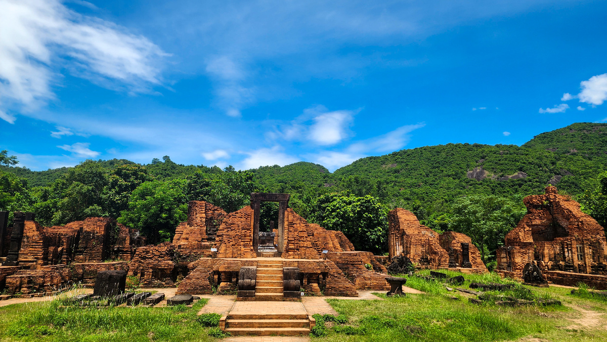
My Son Sanctuary, southwest of Da Nang, preserves one of the most important surviving religious complexes of the Cham civilization.
Inside Da Nang itself, the Museum of Cham Sculpture contains one of the most important collections of Cham art anywhere in Vietnam.
What You Can Still See Today
You do not need to imagine the Cham period from a paragraph in a history book.
You can still connect this part of Da Nang’s history with:
- My Son Sanctuary;
- Museum of Cham Sculpture;
- Cham religious sculpture;
- archaeological sites across Central Vietnam.
For travelers interested in history, this is one of the easiest parts of Da Nang’s past to turn into an actual day trip.
1306–1888: From Former Champa Lands to an Important Port
The political map of Central Vietnam changed gradually.
In 1306, territories south of Hải Vân became part of Đại Việt, beginning a long process in which former Cham lands became increasingly integrated into the Vietnamese state.
Da Nang itself was still far from the modern city we know today.
For centuries, nearby Hoi An was the more internationally important trading port.
Da Nang functioned as part of the same coastal system, but its sheltered bay, strategic location and access to inland routes gradually increased its importance.
By the nineteenth century, Da Nang was becoming a more significant port for foreign trade and state control.
This geographic advantage would keep returning throughout the city’s history.
The same things that make Da Nang convenient today mattered centuries ago:
- a protected bay;
- access to the sea;
- routes through Central Vietnam;
- proximity to the Hải Vân Pass;
- a position between major settlements.
What You Can Still See Today
Modern Da Nang still makes most sense when viewed as a transport city as much as a beach city.
The port, airport, railway, national road network and Hải Vân corridor all continue the same geographic logic.
1858–1954: French Attack, Tourane and the Colonial Port
One of the most important dates in Da Nang’s history is 1858.
Franco-Spanish forces attacked Da Nang at the beginning of the French campaign that would eventually lead to colonial rule over Vietnam.
Later in the nineteenth century, the French gained direct control over the city.
In 1888, Da Nang became a French concession and was known as Tourane.
Under French rule, Tourane developed primarily as a port, commercial center and transport node.
This is important because Da Nang was not being shaped as an old imperial capital like Hue or as a preserved merchant town like Hoi An.
Its value was practical.
It connected goods, ships, roads and the wider region.
That functional identity continued long after the French period ended.
What You Can Still See Today
Da Nang does not preserve a huge French colonial center in the way Hanoi or Ho Chi Minh City does.
The more important legacy is structural.
The city continued developing around:
- trade;
- transport;
- administration;
- access to the coast;
- regional logistics.
That helps explain why Da Nang has always felt different from nearby Hue and Hoi An.
1965–1975: War Changes the City
The Vietnam War transformed Da Nang more dramatically than almost any earlier period.
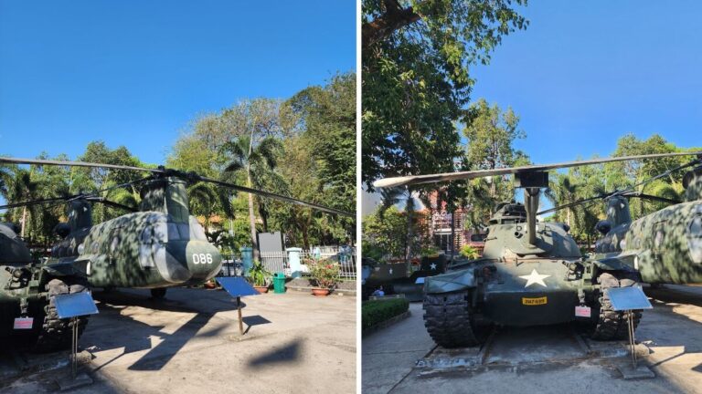
On 8 March 1965, US Marines landed at Da Nang.
Their arrival marked the beginning of a much larger American ground presence in the war.
Da Nang became one of the most important military, aviation and logistical centers in Central Vietnam.
Its airport and surrounding military infrastructure expanded rapidly.
So did the urban population.
But rapid wartime growth did not mean balanced city development.
Infrastructure was shaped by military priorities, logistics and emergency expansion rather than by the needs of a peaceful long-term city.
By the end of the war, Da Nang had experienced years of disruption, population movement and military construction.
What You Can Still See Today
One of the most obvious continuities is Da Nang International Airport.
Today you can land minutes from the city center and reach the beach quickly.
That convenience feels modern, but the airport’s strategic importance predates modern tourism by decades.
The city’s geography made it valuable militarily long before it became useful to millions of travelers.
1975–1997: Reconstruction Before the Big Turning Point
After the war ended in 1975, Da Nang entered a very different period.
The city became part of Quang Nam–Da Nang Province.
For the next two decades, priorities were much more basic than building a polished tourism destination.
Da Nang had to recover from war, rebuild infrastructure and develop within a difficult national economic environment.
It remained important as:
- a port;
- an industrial center;
- a regional transport hub.
But it was not yet the city travelers now associate with clean waterfronts, illuminated bridges and resort districts.
Tourism existed, but it was not the organizing idea of the city.
That changed after 1997.
1997: The Turning Point Behind Modern Da Nang
On 1 January 1997, Da Nang separated from Quang Nam–Da Nang Province and became a centrally governed city.
This is one of the most important dates for understanding modern Da Nang.
The new administrative status gave the city much greater scope to plan its own infrastructure, land use and urban development.
And the physical city began to change quickly.
Da Nang increasingly focused on:
- new roads;
- bridges;
- riverfront redevelopment;
- improved urban infrastructure;
- cleaner public space;
- connections between the two sides of the Han River;
- expansion toward the coast.
This is the period when the basic form of modern Da Nang begins to emerge.
The 2000s: Building the City Across the Han River
If there is one physical feature that tells the story of modern Da Nang, it is the Han River.
Today, crossing the river feels effortless.
Several bridges connect the traditional city center on the west bank with beach districts and newer development on the east.
That was not always the case.
The opening of Han River Bridge in 2000 became both a practical change and a symbol of the city’s new direction.
More crossings followed.
The river gradually became less of a dividing line and more of the visual center of the city.
New roads and development spread toward the coast.
Areas that had once felt peripheral became part of everyday urban Da Nang.
What You Can Still See Today
This transformation is visible every evening.
Walk beside the Han River and you see a city that deliberately turned infrastructure into identity.
The bridges are not hidden engineering projects.
They became landmarks.
That is why structures such as the Dragon Bridge matter beyond their design.
They represent the period when Da Nang began presenting itself as a modern city rather than simply a port.
2010–2019: From Infrastructure City to Tourism City
Once the new urban framework was in place, Da Nang entered another stage.
Tourism expanded rapidly.
International air connections increased.
Beachfront development accelerated.
Hotels and resorts spread along the coast.
My Khe and the eastern districts became increasingly integrated with the city rather than functioning as a separate beach zone.
New landmarks, events and public spaces gave Da Nang a much stronger tourism identity.
The city increasingly promoted a combination that was difficult to find elsewhere in Vietnam:
beach + airport + modern infrastructure + regional attractions
From Da Nang, visitors could easily reach:
- Hoi An;
- My Son;
- Marble Mountains;
- Son Tra Peninsula;
- Hải Vân Pass;
- Ba Na Hills;
- Hue.
This helped Da Nang become more than a resort.
It became a practical base for exploring Central Vietnam.
What You Can Still See Today
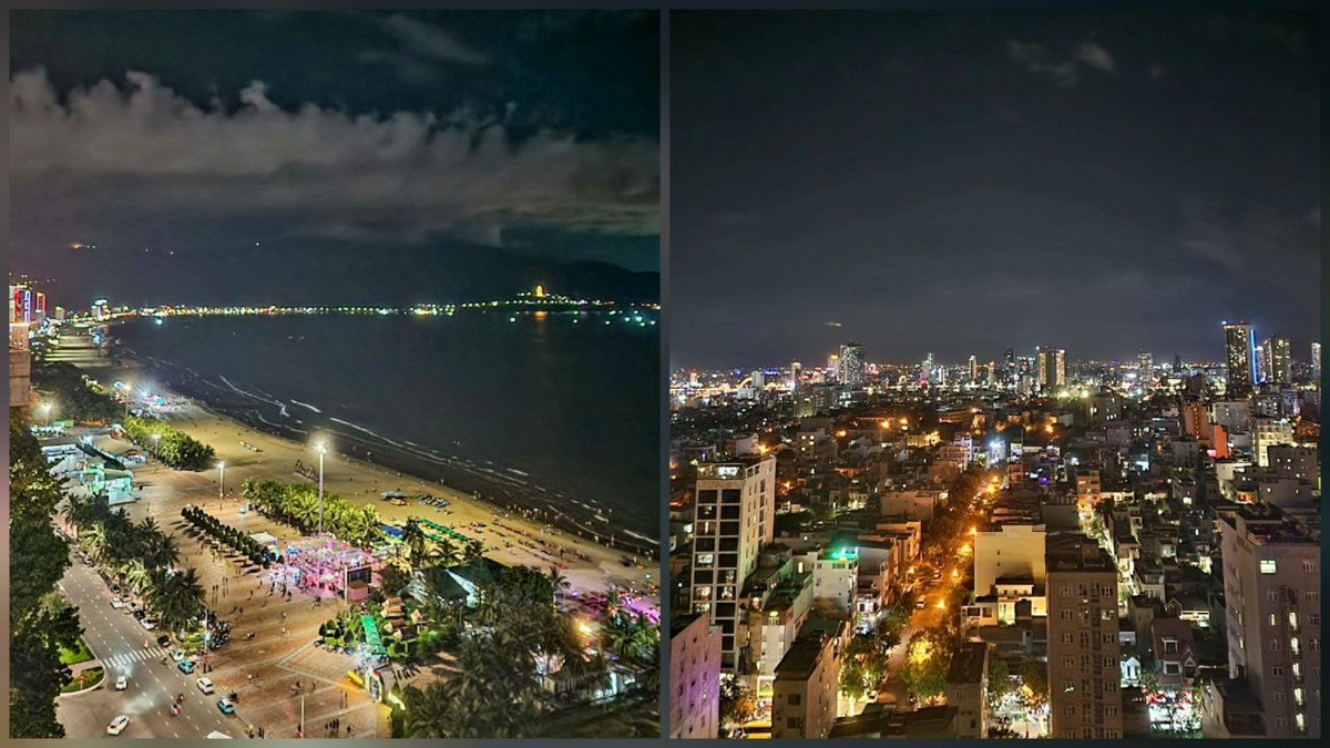
The most visible legacy of this period is the relationship between the city and the beach.
Da Nang is not a historic center with a beach attached far away.
The beachfront districts are now part of everyday city life.
That is one reason the city works for both short holidays and longer stays.

2020–2021: Tourism Stops
The pandemic hit Da Nang’s tourism economy hard.
International travel disappeared, hotels lost guests and businesses built around tourism faced an abrupt pause.
But this period did not reverse the city’s earlier transformation.
The roads, bridges, airport, coastline and urban infrastructure were still there.
When international tourism returned, Da Nang already had the physical base needed to recover.
2022–2024: More Than a Short Beach Holiday
After borders reopened, Da Nang quickly returned to international tourism.
But something else had become more visible.
The city was increasingly attractive to people staying longer than a few nights.
Da Nang offers an unusual combination:
- urban services;
- beach access;
- cafés and restaurants;
- gyms and everyday facilities;
- international airport;
- manageable city scale;
- easy trips around Central Vietnam.
That does not mean Da Nang stopped being a tourism destination.
It means tourism is no longer the only way outsiders use the city.
The same infrastructure that makes Da Nang convenient for a holiday also makes it relatively easy to live in for weeks or months.

2025: Da Nang Changes Scale Again
Then came another major administrative change.
From 1 July 2025, the former centrally governed city of Da Nang and the former Quang Nam Province were merged into a much larger administrative unit under the Da Nang name.
This matters because modern statistics can now be confusing.
When you see the words Da Nang in administrative data after July 2025, they no longer refer only to the compact coastal city around the Han River.
The new municipality covers a much larger territory that includes areas previously administered as Quang Nam.
Its area is roughly 11,860 square kilometers, with a population of more than 3 million people.
For travelers, however, the familiar urban Da Nang remains the coastal core around:
- Han River;
- My Khe;
- Son Tra;
- city center;
- airport.
So when reading older travel articles, maps or statistics, always check whether “Da Nang” means the historic urban municipality or the much larger post-2025 administrative city.
Why Modern Da Nang Looks the Way It Does
Da Nang’s current appearance becomes much easier to understand once you connect the periods.
Champa explains part of the region’s deeper cultural identity.
The port explains why location and logistics have always mattered.
French Tourane strengthened its role as a commercial and transport center.
The war accelerated military and urban growth.
Postwar reconstruction rebuilt the basic city.
1997 gave Da Nang a new administrative framework.
The 2000s tied the city together with roads, bridges and waterfront redevelopment.
The 2010s turned that infrastructure into a tourism advantage.
And 2025 expanded the meaning of Da Nang itself.
The modern city is not the result of one tourism boom.
It is the product of several layers of history stacked on top of the same strategic piece of coast.
What Da Nang’s History Looks Like on the Ground
If you want to connect the history to places you can actually visit, these are the clearest examples:
| Period | Where to see it today |
|---|---|
| Champa | Museum of Cham Sculpture, My Son |
| Maritime and port history | Da Nang Bay and port areas |
| French colonial era | Older central-city institutions and historic urban core |
| War period | Airport and sites connected to military history |
| Post-1997 transformation | Han River waterfront and major bridges |
| Tourism boom | My Khe and eastern coastal districts |
| Modern Da Nang | Dragon Bridge, riverfront, beach districts and new urban development |
This is the easiest way to turn Da Nang history from abstract dates into something visible.
Planning a Trip to Da Nang?
History explains the city, but Da Nang works best when you use it.
For a first visit, I would build the trip around several different versions of the city:
- the Han River and bridges for modern Da Nang;
- the Museum of Cham Sculpture and My Son for its deeper history;
- Son Tra and Hải Vân Pass for the landscape;
- Marble Mountains for a mix of religion, caves and views;
- the beach districts for everyday modern Da Nang.
If you have a motorbike, the city also makes an excellent base for a full day combining the coast, Son Tra, Hải Vân and the areas outside the urban center.
And if you are deciding whether to stay for several days rather than simply pass through on the way to Hoi An, that is where modern Da Nang’s biggest advantage becomes obvious: it functions as an actual city, not just a collection of tourist sights.
Final Thought
Da Nang is easy to underestimate because much of what makes it work looks ordinary.
A bridge that gets you across the river.
A broad road to the beach.
An airport close to the center.
A waterfront that is easy to walk.
But those ordinary conveniences are the result of an unusually compressed urban history.
Da Nang moved from a Cham coastal region to Vietnamese port, French Tourane, wartime military hub, postwar industrial city and finally one of Central Vietnam’s main urban and tourism centers.
The key moment was 1997.
The newest one came in 2025.
And the city you see today is what happened in between.